Walk the Big Four Bridge from Louisville
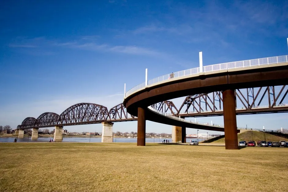
Plan the ramps as well as the span
The Big Four Bridge is a pedestrian and bicycle crossing over the Ohio River between Louisville Waterfront Park and Jeffersonville, Indiana. Waterfront Park describes the bridge itself as about half a mile long, with a quarter-mile ramp at each end; walking from one state to the other and back, including the ramps, totals about two miles.
That makes the crossing approachable but not tiny. Add distance for reaching the ramp, exploring either waterfront, finding restrooms, or continuing into Jeffersonville. A person who announces “just the bridge” may discover the bridge has brought two ramps and a second state to the meeting.
Check conditions on the day
Open the official Big Four Bridge page and Waterfront Park FAQ before leaving. Park rules, hours, construction, events, ice, severe weather, and special closures can change. The park specifically notes that the bridge may close in icy weather and during the Thunder Over Louisville air show.
Use the posted signs and staff directions when they differ from an older guide. Check both Louisville and Jeffersonville conditions if you plan to exit on the Indiana side. Save the current notices offline in case mobile service becomes unhelpful beside the river.
Thunder, lightning, ice, high wind, extreme heat, and poor air quality are reasons to postpone or shorten an exposed river crossing. Bring water and weather protection appropriate to current conditions.
Browse river crossings for more day-of planning habits.
Start from the Louisville ramp
The Kentucky approach rises from Waterfront Park near the Big Four Bridge Lawn. Confirm current parking, transit, bicycle, and accessible-arrival information through official local sources rather than relying on an undated pin. Do not leave valuables visible in a vehicle.
The long curved ramp gains height gradually. Wheelchairs and personal mobility devices are permitted, and Waterfront Park says its walkways were built to ADA standards, but surface conditions, distance, grade, crowding, heat, and individual equipment still matter. Travelers who need detailed accessibility information should contact the park before visiting.
Rest before the exposed span if needed. There is no prize for reaching the state line with the water bottle still ceremonially sealed.
Share the path predictably
Walk to the right unless current markings direct otherwise, look before changing direction, and keep groups from spreading across the full path. Cyclists should travel at a considerate speed and signal passing; pedestrians should avoid abrupt stops in the travel line.
Current Waterfront Park rules allow bicycles but prohibit skateboards, skates, electric scooters, mopeds, motorcycles, and other motor vehicles, while permitting motorized wheelchairs and personal mobility scooters. Pets are not allowed on the bridge; service animals are permitted. Check the current rules before bringing any wheeled device or animal.
Keep children close and avoid climbing, sitting on barriers, or dropping objects. The Ohio River view is broad enough without improving it from the wrong side of a railing.
Decide where to turn around
For the simplest outing, cross to the Indiana ramp, pause in an appropriate area, and retrace the route. If continuing into Jeffersonville, save the intended streets and return plan in advance. A sunset walk can become a dark return, so bring appropriate visibility and know the current park hours.
The bridge's programmed lighting operates after dark, but lighting schedules can change and should not determine safety. Preserve night vision, remain aware of faster path users, and do not stand in a moving lane for a long exposure.
Visit heritage bridges for Kentucky crossings reached by road rather than ramp.
Add history without losing the present
Waterfront Park says the structure was built in 1895 as a railroad bridge, decommissioned in 1969, and opened to pedestrians and bicycles from Louisville in 2013; Jeffersonville completed its ramp in 2014. Present those dates as the park's account, and keep rail-era photographs separate from current access assumptions.
Our Kentucky covered bridge road-trip guide moves from one large urban crossing to smaller rural structures. Both trips reward the same habit: verify today first, then enjoy yesterday. Bridges are unusually persuasive about looking backward, but your feet still need current information.