Plan a Kentucky Covered Bridge Road Trip
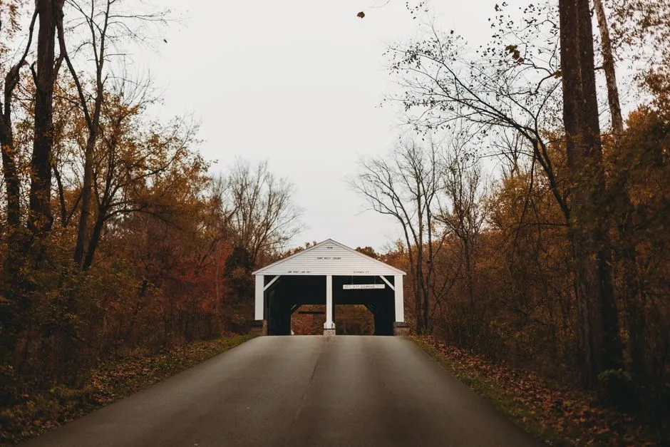
Build the route from current access, not an old list
Plan a Kentucky covered bridge road trip by choosing one geographic cluster, checking each bridge with a current official or local source, and saving its exact approach, access status, parking, and vehicle restrictions before departure. Treat historic dates and present-day use as separate facts: a bridge can remain standing while its traffic, ownership, or visitor access changes. Save a screenshot of the official notice too; rural signal bars sometimes retire before the bridge does.
Fleming County is a practical anchor. Kentucky's official tourism site identifies Flemingsburg as the state's Official Covered Bridge Capital, and the surrounding Northern Kentucky River Region can support a focused day rather than a windshield marathon disguised as heritage appreciation.
Choose two or three realistic stops
Start with a map, not a statewide wish list. Rural roads, slow approaches, photography time, meal stops, and changing daylight make short distances take longer than their mileage suggests. Two or three verified bridges leave room to observe each structure without arriving at the final one as a blur in the rear-view mirror.
Use the Kentucky Transportation Cabinet's current maps for public roads and bridge restrictions, then confirm visitor information through the relevant county, park, or tourism authority. A historic inventory is valuable background but may not describe today's access.
Browse heritage bridges for more source-led route planning.
Use Goddard as a research model
The Kentucky Transportation Cabinet's Goddard Covered Bridge brochure identifies the bridge near the community of Goddard off KY 32 in Fleming County and describes its Ithiel Town lattice design and crossing over Sand Lick Creek. The brochure is historical context, not a live traffic bulletin.
Before visiting, check current local information for closures, construction, weight or width postings, and where a vehicle may legally stop. Obey signs at the site even when an older source says the bridge was open to traffic. Never drive onto a bridge for the photograph unless current signs and rules allow your vehicle.
The well-known view toward the nearby church is a reason to choose a safe, legal position—not to stand in the road until history composes itself.
Treat every bridge as a place, not a prop
Park only in a designated or clearly legal area without blocking roads, gates, drives, fields, emergency access, or neighboring homes. Stay on public paths and respect barriers. Do not climb trusses, attach locks, fly a drone without checking applicable rules, or enter private property for a cleaner angle.
When a bridge carries traffic, remain alert and yield space. Wooden interiors can make an approaching vehicle sound farther away than it is. Keep children close, and do not arrange a group portrait in the travel lane.
Use a normal or short telephoto lens to compress a view from a safe position. Photograph details—joinery, weatherboards, portals, creek reflections, and surrounding road context—without touching fragile material.
Plan for rural-road variables
Download the route and bridge references before leaving; mobile coverage can be uneven. Carry water, weather layers, and a charged phone, and tell someone the plan. Check forecast, flood conditions, road notices, and daylight. Low water beside a bridge is not permission to walk into a creek bed, and high water deserves generous distance.
Allow farm equipment and local traffic room. Drive at a speed that matches curves, hills, surface, wildlife, and visibility rather than the optimistic estimate on a mapping app.
Visit river crossings when the next trip needs a bridge designed for a long walk rather than a brief roadside stop.
Keep a route log with dates
For each stop, save the source, date checked, access note, and any posted restriction observed on arrival. Add historical claims only when a credible source supports them, and distinguish a documented construction date from a broad or disputed estimate.
Our Big Four Bridge walking guide offers an urban counterpoint where the crossing itself is the route. A good covered-bridge day is smaller and slower: fewer stops, stronger sources, legal parking, and enough patience to let a bridge be more interesting than its pin on a map.