Switzer Covered Bridge: Plan a Frankfort-Area Visit
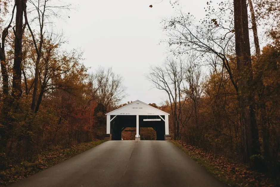
- How should you plan a Switzer Covered Bridge visit?
- Where is it, and what should you confirm first?
- Is it a walking bridge or a driving stop?
- Why is Switzer called Kentucky's official covered bridge?
- What does the older record tell you to notice?
- What does a Howe truss mean here?
- How can you give the visit a workable place in your day?
- What makes a useful record afterward?
- Sources
How should you plan a Switzer Covered Bridge visit?
Plan Switzer Covered Bridge as a focused heritage stop near Frankfort, with current access confirmed before departure. Visit Frankfort describes pedestrian use and closure to vehicles; that is not a same-day opening guarantee. Arrange lawful parking and a permitted approach, stay clear of the creek and road, and pair the stop with a separately checked town visit. Do not enter a closed area or drive through the covered bridge.
The appeal is a single structure you can look at carefully, rather than another long list of places to collect. This guide adds a visit worksheet and a way to read the historical record. Our Kentucky historic-bridges overview compares the wider choices.
Where is it, and what should you confirm first?
The National Park Service's historic nomination places the bridge over North Elkhorn Creek near Switzer in Franklin County. Its location record uses Rocky Branch Road. Treat that archival description as identification, not current turn-by-turn directions.
Save the exact destination before leaving, then establish where visitors may stop and how they should approach on foot. A pin on the structure does not identify a parking space. Ask the local tourism authority about the intended visit date, any closure and the permitted route from parking.
Our suggested message is specific: “We would like to visit Switzer Covered Bridge on our planned date. Is pedestrian access available, where may we park, and are there restrictions on the approach?” Add your party's actual mobility needs. Ask about surface, steps and distance rather than accepting an unexplained accessibility label.
Do not block a driveway, stop in a travel lane or enter private land. If a safe, lawful approach cannot be established, leave the bridge off that day's itinerary.
Is it a walking bridge or a driving stop?
Visit Frankfort's bridge article, published in 2022, describes it as open to pedestrians and closed to vehicular traffic. It also records rebuilding in 1998. This is useful background, but an older visitor article cannot clear today's access or weather conditions.
Plan a visit on foot only after checking permission and conditions. Obey signs and barriers on arrival. Do not infer that an unlocked entrance, another visitor's photograph or somebody else's parked car establishes permission.
Keep children close. Stay on permitted visitor surfaces, away from road traffic, creek banks and water. Do not climb structural members or lean beyond barriers. If flooding, a closure or an unsafe approach affects the stop, turn back; do not improvise another way in.
Why is Switzer called Kentucky's official covered bridge?
Kentucky Revised Statutes 2.270 designates Switzer as the state's official covered bridge. The same section designates Fleming County the Covered Bridge Capital of Kentucky. These are different recognitions, not competing descriptions of the same place.
The distinction helps when planning. Someone searching for the official bridge may want this individual stop; someone planning a county-based collection of covered bridges has a different itinerary. Use our covered-bridge road-trip guide for the broader planning job.
A commemorative designation does not tell you whether a destination is open, accessible to your party or suitable for your vehicle. Keep recognition in the history column and present access in the practical column.
What does the older record tell you to notice?
The NPS nomination dates original construction to around 1855 and describes sawtooth edging above the entrances. Its main description gives a length of sixty feet, but a continuation sheet corrects that figure to 120 feet. Read the complete record rather than copying the first number encountered. The nomination also recounts local opposition to replacement and the completion of an adjacent bridge in 1954.
That makes preservation part of the visit, not an afterthought. In your notes, distinguish the original construction, later work and the date of the document you consulted. Do not label every visible piece of timber as original or treat an archival condition assessment as a current inspection.
Choose a detail to observe from a permitted position and record what you can actually see. If an entrance detail is obscured, leave the observation unfinished. A travel notebook can contain a question; it does not need a confident identification for every surface.
What does a Howe truss mean here?
Visit Frankfort identifies the bridge's design as Howe. The Federal Highway Administration's covered-bridge manual explains Howe's use of metal vertical rods in a timber, parallel-chord, cross-braced truss. Its diagram is a useful companion for understanding the design vocabulary before the trip.
Use the diagram for recognition, not inspection. It does not authorize visitors to assess load capacity, test a connection or decide a closed structure is safe. Photograph only from permitted positions, without touching or climbing the framework.
An observation can be simple: draw the overall outline, mark a detail you recognized and list something to look up afterward. There is no need to turn a quiet stop into an engineering examination.
How can you give the visit a workable place in your day?
Make the bridge one part of a plan with an alternative. The following is our planning worksheet, not a measured itinerary or a promise about facilities.
| Decision | Write down before departure | If unresolved |
|---|---|---|
| Arrival | Confirmed visitor approach and lawful parking | Omit the stop |
| Walking needs | Surface, distance and any steps relevant to your party | Ask before traveling |
| Conditions | Current access and weather information | Choose the alternative |
| Next stop | Its own address, opening arrangements and arrival needs | Keep the afternoon flexible |
| Return | Departure requirement and realistic travel allowance | Remove an optional activity |
Include travel between stops, time to find the permitted entrance, and the return to your vehicle. Avoid deriving a visit duration from the bridge's length. Reading interpretation and managing an approach are different activities from walking across a span.
For a town pairing, consider the Thomas D. Clark Center for Kentucky History. The Kentucky Historical Society describes exhibition spaces, a research library and collections there. Check the current visitor arrangements directly; a research-library visit and a museum visit may need different preparation.
Choose the pairing because it suits your interests, not because two attractions appear in the same article. Confirm travel separately and keep an indoor alternative available when the bridge visit is unsuitable.
What makes a useful record afterward?
Keep the date, sources consulted, permitted route used and the detail that interested you. Separate your own observations from historical claims. A photograph proves what was visible from your position, not the age or condition of every component.
If a notice prevented entry, record that fact without converting it into a permanent closure announcement. Future visitors need the responsible authority's current information. Your own successful visit likewise cannot guarantee theirs.
The best result is a small, well-understood outing: a structure placed in its history, an approach that respected the site and a plan that could change when conditions required it.